Geography · KS3 to A Level · £4.99
Geography
Key Terms
Every word a geography department teaches, Year 7 to A Level, in one A4 book. Each key stage gets its own pages: the terms grouped the way they are taught rather than alphabetically, a definition that fits on two lines, and a worked example beside almost every one. Each key stage opens on one invented map extract, annotated — map and fieldwork skills, the one thing every other band in the book is read or measured through — and the numbers on it appear again beside the same words in the list; a further twelve pages carry a real drawn figure wherever a picture genuinely teaches faster than a sentence: a river's long profile, the headland sequence, a plate boundary, a population pyramid, a storm hydrograph. Then a page on using the words: the ones the assessment itself is written in, the false friends that mean something else in a geography classroom — a basin is not a sink, a delta is not a Greek letter, scale is not fish skin — the same point written weakly and then properly, and what each word becomes at the next key stage.
£4.99The whole book, Year 7 to A Level, 14 pages
- A4 PDF
- every page shown, part-blurred
- instant download
One purchase covers the school that buys it. Print it, copy it, hand it round your department. Not for passing to other schools or uploading anywhere.
PDF download, ready straight after payment. Downloading it ends the 14-day right to cancel; a file that is faulty or not as described is always refunded. Refunds
Read before publication by serving senior leaders, in school.
5.0 from 24+ reviews on Google
Schools that have bought from Empower Educators include Nottingham High School, Northampton High School GDST and Sutton Valence School.
Everything else this site has for Geography: Geography teaching resources
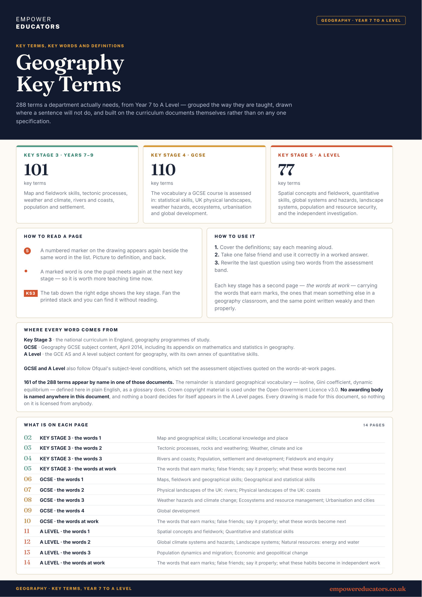
A pupil who knows a word is not yet using it. This book is built around that gap. The words for each key stage sit in the groups they are taught in, each with a short definition and a worked example, and a marked word is one the pupil meets again at the next key stage, so a department can see where its vocabulary carries forward and where it changes name. Every key stage opens on one annotated map, because band one is always map and fieldwork skills — grid reference, scale, contour, symbol, key and relief at Key Stage 3; a six-figure reference, gradient and cross-section at GCSE; a choropleth, an isoline and spatial pattern at A Level — and twelve further pages carry a real drawn figure wherever the idea is genuinely easier to see than to read: a meander's erosion and deposition sides, the cave-arch-stack-stump sequence, a glaciated valley's cross-section, a demographic transition curve, the concentric rings of an urban model.
Every key stage closes on a page about using the words. The words the assessment is written in, quoted from Ofqual where they are theirs — and GCSE Geography carries four assessment objectives, not the three most subjects share. The false friends: scale, basin, delta, bar, resource, sustainable, resilience, threshold, each a word a pupil already owns in another sense, contrasted with what it actually means here. The same point written weakly and then properly. And a table of what each habit is called at the next stage, so "naming a landform" at GCSE is already "explaining its formation as a sequence of named processes" by the time it is assessed at A Level. Nothing a board decides for itself is in it, and no map is real: every map, cross-section and graph was drawn for the book.
- Written to
- The DfE's national curriculum programmes of study for geography at Key Stage 3, the Geography GCSE subject content (April 2014, DFE-00345-2014) including its appendix on mathematics and statistics in geography, and the GCE AS and A level subject content for geography (DFE-00693-2014) with its own annex of quantitative skills; both GCSE and A Level also follow Ofqual's subject-level conditions, which set the assessment objectives quoted on the words-at-work pages; 161 of 288 terms appear by name in one of those documents and the cover says so, the rest are standard geographical vocabulary defined here in plain English; no awarding body is named, and nothing a board decides for itself appears in the A Level pages
- Intended for
- geography departments: printed one per pupil, kept in the front of an exercise book, or put on the wall by key stage
- Extent
- 14 pages · 13 sections
Look inside
Real pages, straight from the PDF
Click any page to see it full size.
Contents
All 13 sections
Taken from the book’s own contents page, so the page numbers are the real ones.